
Strategic Solutions for Complex
Real-World Problems
SkyBridge MEBA develops integrated intelligence architectures around problems that cannot be solved by a single technology, dataset or institution. Our strategic project bank explores how aerial systems, satellite observation, GIS, remote sensing, field intelligence, analytics and digital platforms can be combined to strengthen visibility, verification and decision-making.
The solutions presented below are selected strategic concepts and proposed institutional intelligence systems developed by SkyBridge MEBA. Their inclusion does not imply Government approval, commissioning or contractual engagement.
From Problem to Intelligence System
"We design the intelligence architecture around the problem, not the other way around."
CR-FERIS
Cross River Forest & Environmental Resource Intelligence System
CR-FERIS is a proposed integrated forest and environmental intelligence system designed to strengthen visibility over forest resources, environmental change, vulnerable locations and selected infrastructure through the integration of UAS observation, satellite imagery, GIS, field verification, data analytics and decision-support tools.
Potential Intelligence Functions
Potential Institutional Value
CR-FERIS is a SkyBridge-developed strategic concept. Its inclusion does not imply Cross River State Government approval or commissioning.
NECPEIS
National Environmental Compliance, Pollution & Ecological Intelligence System
A proposed integrated environmental intelligence architecture designed to support responsible institutions with improved visibility of pollution, ecological change, environmental incidents and compliance-related information. Regulatory enforcement remains the responsibility of authorised Government institutions.
Potential Applications
Regulatory enforcement remains the responsibility of authorised Government institutions. NECPEIS is a SkyBridge-developed concept designed for institutional consideration.

CMIBESI
Calabar Maritime Intelligence & Blue Economy Surveillance Initiative
A proposed coastal and maritime intelligence architecture designed to improve visibility across selected maritime, fisheries, coastal-environment and blue-economy activities within the Calabar maritime axis and potentially similar environments.
Potential Applications
CMIBESI is a SkyBridge-developed concept. It does not imply law-enforcement authority or an existing Government mandate.
NCIIRS
National Critical Infrastructure Intelligence & Resilience System
A proposed intelligence architecture for improving visibility, mapping, monitoring and resilience planning around geographically distributed critical infrastructure.
Potential Applications
SkyBridge MEBA is not a national security or enforcement agency. NCIIRS is a proposed intelligence support concept.
NREAIAS
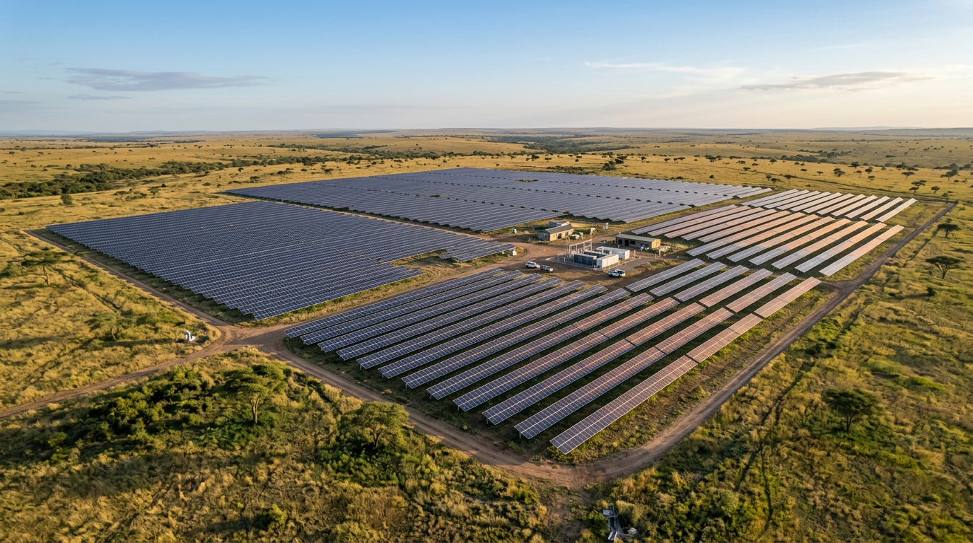
National Renewable Energy Asset Intelligence & Assurance System
A proposed geospatial and digital intelligence architecture for improving visibility, verification and lifecycle intelligence around renewable-energy assets and programmes.
Potential Applications
NREAIAS is a SkyBridge-developed concept. It does not imply endorsement by the Rural Electrification Agency or any other Government institution.
NAIFS-CRS
National Agricultural Intelligence, Food Security & Climate Resilience System
A proposed integrated agricultural and climate-intelligence architecture designed to improve visibility of agricultural land, production environments, climate exposure and selected food-security indicators.
Potential Applications
TET-IIMAMS
Tertiary Education Trust Fund Integrated Institutional Mapping, Asset Monitoring & Management System
A proposed geospatial intelligence and asset-management architecture designed to improve visibility, verification and lifecycle monitoring of institutional infrastructure and intervention projects.
Potential Applications
TET-IIMAMS is a SkyBridge-developed concept. It does not imply TETFund approval, sponsorship or commissioning.
CR-PIMPAS
Cross River Project Infrastructure Monitoring & Performance Assurance System
A proposed intelligence architecture for strengthening visibility, geo-referenced monitoring and performance assurance across selected public projects and infrastructure.
Potential Applications
CR-PIMPAS is a SkyBridge-developed concept. It does not imply Cross River State Government approval or commissioning.
One Intelligence Philosophy.
Multiple Sectors.
Sector-specific applications of a common SkyBridge intelligence architecture.
The Architecture Beneath the Projects
Data Sources
Intelligence Products
Start Controlled. Prove Value. Scale Deliberately.
Diagnostic
Define the problem and information gap.
Pilot Design
Select geography, assets, datasets and success measures.
Baseline
Establish initial evidence and reference conditions.
Deploy
Implement approved observation, mapping and analytical workflows.
Verify
Assess outputs against agreed KPIs.
Institutionalise
Integrate reporting, dashboards, governance and operating procedures.
Scale
Expand only after evidence supports wider deployment.
Built for Collaboration
SkyBridge strategic solutions can be structured through appropriate models involving:
Partnership structures depend on project requirements, mandate, procurement, financing and applicable regulation.
Project names, system architectures, concept frameworks and associated materials presented on this website represent intellectual work developed by SkyBridge MEBA Integrated Aerial Systems Ltd., except where otherwise stated. Detailed technical, commercial and implementation documentation is available only through appropriate engagement and confidentiality arrangements.